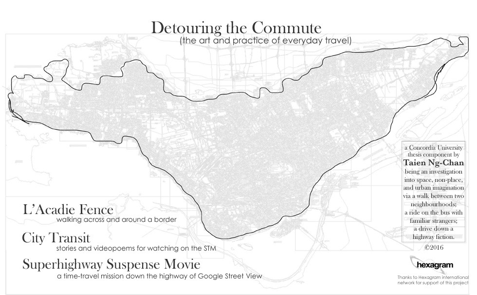
Detouring the Commute investigated three different and specific kinds of commutes, and resulted in three different media works. The first involved a walk between two very different neighbourhoods that involves crossing the controversial border that is the L’Acadie Fence, a chain-link fence that stands on the border of two neighbourhoods : Parc-Extension (PX) and Town of Mount Royal (TMR), and one of Montreal’s most pronounced symbols of power relations. I encountered it almost daily on my walking commute. In attempting to closely examine the lived spaces of my urban everyday, the recurrence of routine along with the accumulation of personal and collective meaning, I began to read and document the urban landscape as I moved through it. On my commutes, I made a habit of taking my camera as a way not only of capturing the passage of time and space, but of provoking my attention to the landscape. The fence, being a major border as well as the subject of stories, rumours and general feelings of “gatedness,” naturally attracted my attention, both photographically and theoretically. The making of the L’Acadie Fence photo-collage thus became a literal detour for me. It took me out of my usual way and my normal routine, giving impetus to go all the way around it, all 1.6 kilometers – not everyday, of course, but whenever I could make a bit of extra time.


Documenting the entirety of the fence also meant that I was turning it into an aesthetic object, but one that held tensions in the differences of its surrounding environments and ambiances. As I composited the photos together, I concentrated on not making a seamless panorama, as many other works more or less do – see, for instance, Edward Ruscha’s artist book of Every Building on the Sunset Strip (1966), or Stan Douglas’ Every Building on 100 West Hastings (2002). The latter is perhaps more directly connected with L’Acadie Fence in terms of intent (for the book project similarly documents a boundary through both photo and essay, this time to Vancouver’s Downtown Eastside, one of the most contested inner-city neighbourhoods in the country). The resulting photographic collage, composed of images from my walking commute, is thus an archive of my journeys around and through the fence, and makes no attempt to present a unified perspective, illustrating the multi-faceted nature of urban sites, especially contested ones.
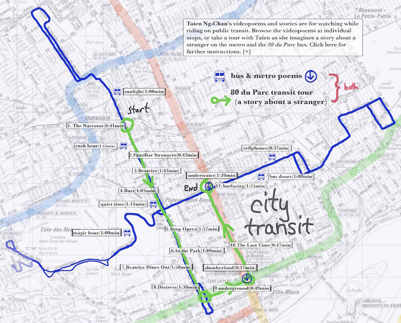
My second commute related the experience of city transit as a unique liminal space of performance. The conjoining of two main elements of city transit, the “bubble” of solitude and the near-ubiquity of mobile media, makes it the perfect space to engage in a poetic and cinematic practice. My multimedia map City Transit is composed of short videopoems and stories that were shot on the buses and metros that I took every day, particularly my commuting routes such as the 80 Avenue du Parc, which took me from my home in Parc-X to the downtown core. Equally, depending on mood, I would take the metro from Parc Station on the Blue Line, transfer to the Orange and then to the Green Line. It took roughly the same amount of time. For a while, each trip became a gathering session of images and sounds.

On the bus, I used my cell phone to slyly capture behaviours and events like people sleeping, reading, on their cell phones, or sunlight moving across the bus seats. I took video on the lowest resolution, blown up to emphasize the noise and the glitches of the digital format as a form of abstraction and to de-emphasize individuality. I traveled with my eyes and ears open, always looking for images to shoot, or interesting sounds. The images began to categorize themselves: sleepers, readers, headphones, cellphones. I began to notice how the light changed throughout the day on the bus, how the metro induced people into sleep. I listened to conversations, cellphone rings, and engine noises. Taking public transportation each day became a practice of seeing, listening, concentrating, sitting. This practice of gathering images is similar to the one used during the walking commute, for the act of looking, framing, and composing changed my relationship to the urban environment and the way I saw the city. The resulting archive is both documentary and poetic in nature. Over a period of about 2 years, I collected around 200 short cellphone and digital camera videos, as well as 30-40 sound recordings.
In addition to the act of documentation, I add imaginative fiction. I turn the space of social performance into a theatrical performance by staging a narrative. The idea for the story came to me a long time ago from a brief glimpse of a woman with a black eye that I saw on the bus, sitting at the back and wearing a thin blue coat. Something about her made me want to ask if she was okay, but I didn’t. What responsibility does one have for another? The question came back to me often. There were familiar strangers that I saw occasionally on the bus or around the neighbourhood, had seen them around for years but had never met them. I had fragments of stories for them as well. These imaginings were also part of the strata of place. For the City Transit map, these poems and story fragments are laid out on hand-drawn routes over a bus map from the STM (Société de transport de Montréal). City Transit aims to layer stories and poems, made from my archive of images and sounds, over the particular spaces of urban travel in Montreal, to possibly give the viewers a sense of aesthetic and narrative pleasure that might even change how they look at their fellow passengers on the bus or metro.

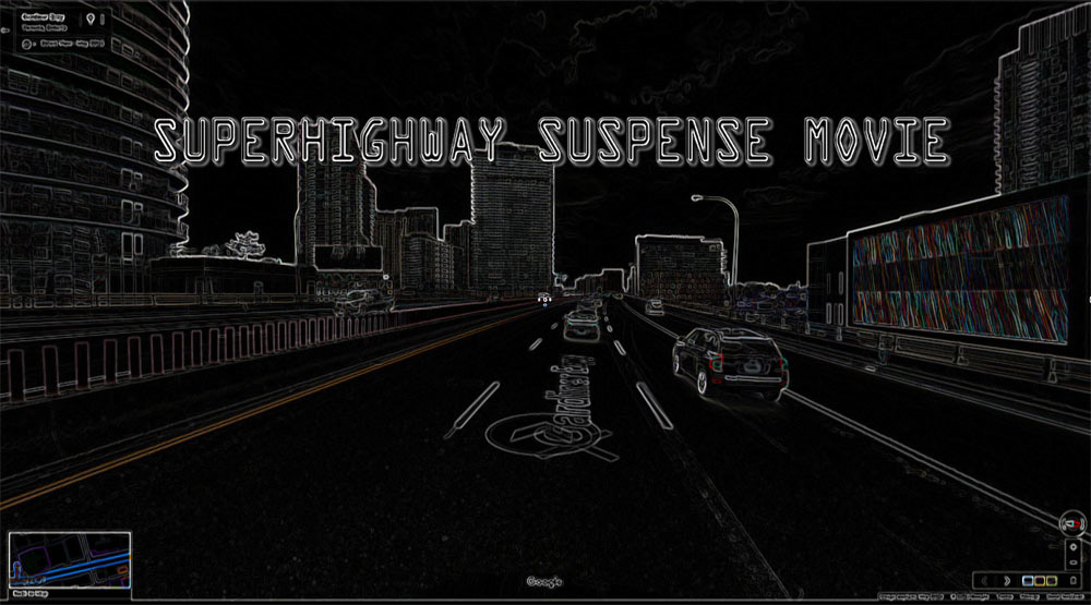
Finally, the third commute describes a drive from one city to another in rush hour traffic, as a way of discerning narratives that build up around the non-places of the auto-commute. My idea for creative research of the auto-commute was to manifest some of the narratives often found in movies, about the car, associations of suburbs and stripmalls, disaster films and the space of the highway, woven together with a narrative about the routine drive. I was going to use some of the same methodologies as in the first two works, such as the archiving of images as I drove down the highway. I had considered perhaps shooting some Super 8 film or cell phone video footage. But as I drove around in Google Street View while researching highways, I realized that this simulated and ghostly world was a far better fit for the fragments of narrative in Superhighway Suspense Movie (spoken by text-to-speech robots) that evoke dystopian futures. The idea of images as a tool of time-travel presented itself, partly in reference to Chris Marker’s La Jetée (1962), where a man is selected to go back to the past precisely because of the strength of an image in his mind. In Superhighway Suspense Movie, movies, internet images, and the paths of GSV are seen as an archive of the past through which one can travel. Google Street View is a very particular kind of cinema with its unmistakable aesthetic, one that is locative at the same time.
I began the process of driving in Google Street View down the highway between Toronto and Hamilton, where I now live, down a route that has become very familiar. A trip that normally takes under an hour by car (without traffic, of course) took several days by GSV. I had originally planned on using a Javascript that would automatically make a “fly-through” video, and had also experimented with Google Earth’s ability to record itineraries and motions and export them as movies. However, because I wanted more precise control of the images, I ended up doing it manually, clicking through the map, and taking a screenshot of my browser window every few “steps.” Superhighway Suspense Movie is thus an animation composed of nearly 2000 screenshots of Google Street View. Nowadays, when I drive down the highway to or from Toronto “in real life,” things stand out in my memory from GSV. Buildings and views that I had never noticed before suddenly become landmarks. My trip down the highway has become a cinematic time-space layer that has changed the way I see that particular part of the auto-commute, an unexpected part of that one detour that was the making of Superhighway Suspense Movie.
The creative process linked to this research on everyday travel produced very different works, each beginning from a different set of artistic research concerns that have helped to frame the outcomes. During the walking commute, I began with the urban landscape, the built environment and city planning, as read from the route of my pathway, and through the lens of my camera. The liminal bubble of the transit commute proved to be an excellent place from which to map social strata as well as hybrid and networked mobile spaces, especially through locative mobile media art. The chronotopes of the auto-commute form more strata through the images and narratives in cinema. My project makes use of aspects of each of these practices (which are not exhaustive, as they represent only a handful of possible techniques) as tools for deeper knowledge.
List of Media Works
All works listed here are by Taien Ng-Chan, exhibited at the Re:Create Emerging Researchers’ Symposium, and can be viewed at soyfishmedia.com
1. L’Acadie Fence
Digital photo-collage.
Original dimensions: 22” x 1800”
An early version was first exhibited digitally at Contested Site: Archives and the City,
FoFA Gallery, Montreal, 2012.
2. City Transit
Multi-media website featuring 19 videopoems and narrative fragments made for watching while riding city transit. Original media formats include digital cell phone video, digital camera video, Super 8 and Super 16mm film.
Produced as part of a collaborative website project, Detours: Poetics of the City,
in residency at the artist-run centre Agence TOPO, 2012. Presented at the BIAN 2012.
3. Superhighway Suspense Movie
Digital video.
Length: 6 minutes 38 seconds.
Music and soundmix by Christina Sealey.
An early version of this video was first exhibited at Stories of the City, curated by the In/Terminus Research Collective at the University of Windsor, in November 2015.
Many thanks to Hexagram International Network for support of this project.
